
 Kontakt
 Ako nakupovať

Doručenie
Nákupný poradca
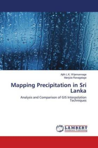
Mapping Precipitation in Sri Lanka
Analysis and Comparison of GIS Interpolation Techniques
 Angličtina
 78 b
Až 30 dní na vrátenie tovaru
Zákazníci tiež kúpili

 /
 Brožovaná
 25.68
€








 /
Brožovaná
35.31
€

 /
Brožovaná
15.04
€



 /
Brožovaná
42.44
€




 /
Brožovaná
9.62
€



 /
Brožovaná
70.53
€
 /
Brožovaná
90.60
€


 /
Pevná
64.51
€



Precipitation is a highly important and a key input for many hydrological and ecological models, including water resource management, recharge assessment, irrigation scheduling, vegetation, and crop production models. However, rainfall records are often incomplete due to the missing rainfall data in the measured period or insufficient stations in the study region. The spatial interpolation method is one of the most common technique, and it is frequently used to estimate values of meteorological parameters in locations where they are not measured or missing. The use of different interpolation schemes in the same catchment may cause significant differences and deviations from the actual spatial distribution of rainfall. It is needed to compare the performances of each interpolation method to get excellent interpolation technique. GIS is offering the vast rage range of statistical methods to interpolate precipitation based on data recorded at several irregularly spaced gauges. In this analysis, five methods were used to predict monthly precipitation, and each technique was compared.


Informácie o knihe
Angličtina

Darujte túto knihu ešte dnes
Je to jednoduché
1 Pridajte knihu do košíka a vyberte možnosť doručiť ako darček 2 Obratom Vám zašleme poukaz 3 Knihu zašleme na adresu obdarovanéhoMohlo by vás tiež zaujímať





 /
Brožovaná
18.65
€


















Ahoj! Som Libroamiko, tvoj knižný radca.
Ako ti môžem pomôcť?