 Kontakt
 Ako nakupovať
Doručenie
Nákupný poradca
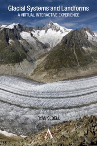
Glacial Systems and Landforms
 Angličtina
 68 b
68 b
30 dní na vrátenie tovaru
Zákazníci tiež kúpili

 /
/
 Brožovaná
 16.20
€
16.20
€
 /
Brožovaná
44.55
€
/
Brožovaná
44.55
€

This interactive guide serves to make glacial systems and landforms more accessible, as students use Google Earth and other satellite imagery to understand the patterns and processes found within glacial environments. Guided inquiry activities range from calculating the Mendenhall Glacier's rate of melting to identifying erosional landforms in the Swiss Alps. In this way, the guide offers a virtual interactive experience in which students can visit and explore glacial systems and landforms in 3D. Through studying these images the student will not only start to recognize the forms commonly found within glacial landscapes, but also develop skills in map analysis and interpretation.


Informácie o knihe
Angličtina

Darujte túto knihu ešte dnes
Je to jednoduché
1 Pridajte knihu do košíka a vyberte možnosť doručiť ako darček 2 Obratom Vám zašleme poukaz 3 Knihu zašleme na adresu obdarovanéhoMohlo by vás tiež zaujímať


Ahoj! Som Libroamiko, tvoj knižný radca.
Ako ti môžem pomôcť?